By Kelly Brodbeck
Using small drones, or unmanned aerial vehicles (UAVs), for wildfire mitigation and response offers several time-saving and safety benefits.
First and foremost, drones can access areas that may be difficult or impossible for ground crews to reach, such as steep terrain or areas that are potentially unsafe because of recent fire activity. This allows for safer operation, more efficient monitoring, and early detection of spot fires and fire activity. Drones are also effective for condition monitoring tied to identifying potential fire problem areas, which is crucial to understanding fire risk prior to an incident, in addition to planning an effective response.
Another benefit is the ability to capture high-resolution, multispectral imagery, such as in visible and infrared (thermal) light, prior to, during, and after a wildfire event. This data can be analyzed quickly by experts and used to make informed decisions about how best to respond. Sharing that data with government agency partners involved in wildfire response can also help reduce the risk for all.
Scappoose (OR) Fire Department Chief Jeff Pricher, whose department covers rural forested areas susceptible to summer forest fires, believes that data captured through unmanned aircraft prior to a fire event is critical for decision making. “Unmanned aviation programs can provide vital data for utilities, and they can then share that information with all the stakeholders,” says Pricher. “For example, if a transmission line survey was completed two weeks before a wildfire, that information can be shared with firefighters, state and federal park service authorities, the Bureau of Land Management, or other state agencies so that data can be integrated into the response strategy.”
During an incident, using drones can reduce costs associated with wildfire management. Traditional methods of fire prevention often involve large teams of personnel or require expensive equipment to inspect fire lines, such as a piloted helicopter or fixed-wing aircraft. With an unmanned system, a single drone operator can provide fire activity information from a large area at a fraction of the cost. This not only saves money but also frees up resources that can be allocated elsewhere, in addition to improving safety.
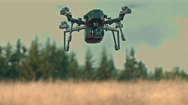
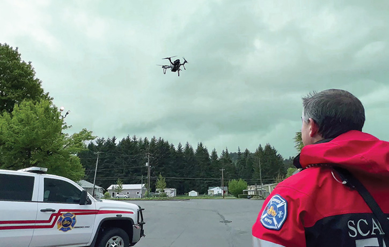
1 Drones can access areas that may be difficult or impossible for ground crews to reach, such as steep terrain or areas that are potentially unsafe because of recent fire activity. (Photos courtesy of Teledyne FLIR.)
The right drone must be small enough to be carried across difficult terrain, but it also must be powerful enough to handle the winds and airborne particulates that often accompany fire activity. It should have additional sensing technology beyond a visible camera, such as a thermal camera or light detection and ranging (LIDAR), to be able to spot heat issues and other terrain characteristics that can affect decision making—things that might be invisible to the naked eye or a system with just a visible camera. The drone must be able to fly when and where the mission demands, meaning it cannot be subject to geofencing capabilities that can prevent drones from flying into certain areas.
THE RIGHT SIZE/WEIGHT BALANCE
One of the primary benefits of using small drones is getting eyes in the sky at a lower cost while also improving safety, as the pilot and associated personnel can keep their feet firmly on the ground. However, wildfires often occur in remote areas, potentially requiring the pilot to hike in or otherwise hand carry the drone to a location close enough to the hot zone because of limited flight time and range.
The downside is a drone that can be carried in a backpack might also be too small and light to stand up against the wind conditions associated with wildfires. Therefore, pilots need to balance the competing needs of a drone that is light enough to carry, even in tough terrain, and one that is stable enough to fly through strong winds of 20 miles per hour (mph) or more.
2 Check with your state agency for any specific local requirements for operating drones.
MULTISPECTRAL IMAGING IS A MUST
The drone should also have a thermal camera payload at minimum or, better yet, a single payload with both a thermal and visible camera that can provide visible and thermal images or an image that combines the two. That drone should also include an easy method to swap out payloads for additional capabilities such as LIDAR. In a wildfire scenario, heavy smoke can blind a drone’s visible camera system, but with thermal imaging, the drone will be able to see through darkness and smoke more effectively to locate personnel and property in danger. Here, LIDAR can also be an effective tool to get a lay of the land to determine the best approach to respond.
Thermal imaging is also applicable for “mopping up,” or the ability to locate and defuse hot spots on the ground where a future fire might flare up again in the right conditions. Such hot spots may not have an active flame or give off visible smoke, making them difficult to locate safely without the aid of a thermal imaging camera.
Here, thermal-equipped drones can supplement fire personnel on the ground who are looking for hot spots. A single drone can quickly cover a large area, helping to improve efficiency by identifying exactly where a crew needs to go to handle hot spots and for post mop-up confirmation. This can speed up the operation and potentially improve the safety of personnel while also helping ensure a devastating wildfire won’t flare up again in the near future.
GEOFENCE FREE
To protect the security and safety of sensitive airspace around locations such as airports or government facilities, many drones operate with a virtual wall that restricts movement into sensitive airspace, otherwise known as a geofence. Geofences are virtually constructed around specific locations using a combination of technologies including satellites, GPS, and the internal software of the drone. It has proven to be an effective tool to ensure drones don’t fly into places they should not. However, in a wildfire scenario, geofencing can be a major detriment to effective fire mitigation.
Therefore, the drone operator will need a drone that is not subject to geofencing or one with a geofence override feature. Whether the drone is conducting a fire mitigation maintenance inspection or used as part of a wildfire response, placing full control of the drone in the pilot’s hand is mission critical.
DRONE CERTIFICATION FROM FAA
Operating professional-grade drones during wildland firefighting incidents requires education, training, and multiple certifications. Check with your state agency for any specific local requirements.
Overall, the benefits of using drones for wildfire mitigation are clear. They offer quicker response times, more accurate data collection, improved efficiency, and potential cost savings while helping protect lives and property from devastating wildfires.
KELLY BRODBECK is a product management executive at Teledyne FLIR.